Maps

12 Comments

Observer, 1 September 1940, 7

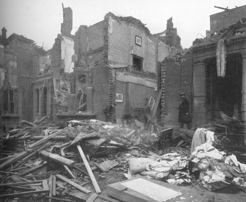
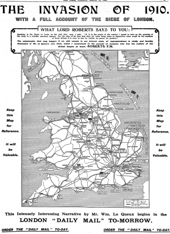
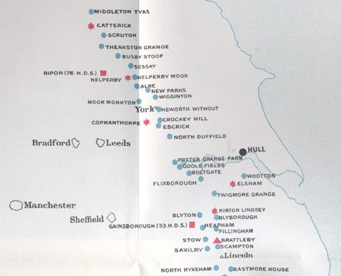
The New Statesman was a little off in its belief that the Germans have given up 'blitzkrieg' tactics, as yesterday they renewed their heavy daylight assaults against RAF aerodromes. According to the Observer (above, 7) they also targeted 'women shoppers' in two places near or in London.

On page 8, there's a handy map to help readers keep track of the strategy of the 'Battle of Britain' -- the hatched areas are the 'principal industrial areas' in each country.
...continue reading

8 Comments


View Zeppelins over London in a larger map

Last year, Londonist gave us a very nifty map of London's V2 impact sites. Now they've come up with an equivalent for Zeppelin raids. Each of the sunbursts represents a bombfall. Clicking on them brings up a popup with information about the site and casualties (but, annoyingly, not the date). Note, however, that only a 'small selection' of the sites are plotted, however, which makes it hard to draw conclusions from the patterns: I could be wrong but I don't think the cluster in central London is representative. But perhaps more interesting are the tracks of the Zeppelin raiders (to get the key for which raid was when, click on the 'larger map' link). Again, these need to be treated with some caution, as they would only be reconstructions based on logbooks, bombfalls and sightings, but they do suggest that if the raiders could get reasonably close to London they could usually work out where to go. You can see the tracks deviating towards the urban areas, or turning back after the bombing run. London did have a blackout during the First World War (when its fighters couldn't touch the Zeppelins, the government claimed that the best defence against them was 'darkness and composure') but it wasn't as complete as during the Second. And of course the Thames on a clear and moonlit night couldn't be blacked-out at all.

Also, note the link in comments to a sequence of photos showing a Zeppelin being shot down. I hate to say it but I think these are fake ...

10 Comments

61-67 Warrington Crescent

This is Warrington Crescent, Maida Vale, on the morning of 8 March 1918, after it had been hit by a 1-ton bomb dropped by a Giant bomber the night before -- one of the largest to fall on London during the First World War and the most materially destructive. Twelve people were killed (including Lena Ford, who wrote the words to the song "Keep the home fires burning"). It was the first air raid to come in the dark of the moon and, fortunately, the second-last of the war.
...continue reading

10 Comments

The Invasion of 1910

William le Queux's The Invasion of 1910 is today one of the best-remembered of the Edwardian invasion novels (at least to anyone interested in the topic). Not because of any literary value -- very few people read it today, and I can't blame them -- but because of its contemporary success. It was commissioned by the press magnate Lord Northcliffe and serialised in his Daily Mail in 1906. And heavily promoted in all his papers, as we can see here -- this is a full page ad from The Times (13 March 1906, 11). The Invasion of 1910 was a huge hit, selling many newspapers and over a million books in a couple of dozen languages, making it the most successful future war story since The Battle of Dorking back in 1871. Northcliffe being Northcliffe, there was also a political objective: the scuppering of the government's proposed Territorial Force, which was widely derided by Conservatives as an ineffective substitute for conscription (sorry, 'national service'). The ad and the book both feature a personal recommendation by Field Marshal Lord Roberts, president of the National Service League.
...continue reading

16 Comments

Air War and How to Wage It

Noel Pemberton Billing has received a bit of criticism around here, and mostly for good reason. He couldn't design a decent aeroplane for toffee, he peddled lurid conspiracy theories, he was a relentless self-promoter. But I don't think he was a complete fool. He clearly had a fertile imagination (overly so, Maud Allen would have said) and sometimes he was on the money. Take his ideas for Britain's air defence, as expounded in his 1916 pamphlet Air War: How to Wage It.

There were two major problems at the time. The first was that Zeppelins were raiding British cities and weren't being intercepted, despite the existence of a substantial home defence establishment. It wasn't that they couldn't be intercepted, but that they couldn't be intercepted consistently. (Shooting them down was another a problem, of course.) The problem was one of command, control, communications and intelligence (C3I, though you can add letters to taste). Information about incoming Zeppelins and their locations usually wasn't timely or accurate, making it hard for fighters to find them in the dark. And most squadrons were based near the coast, meaning that the enemy was usually past the defences by the time the alarm was raised.

The second problem was that because the targets of the raiders were difficult to determine -- and for that matter, the Zeppelin crews themselves often didn't know where they were and dropped their bombs almost at random -- as a precaution alerts had to be sounded and lights blacked-out over large areas of the country. This disrupted sleep and production far more than was necessary.

...continue reading

25 Comments

[Cross-posted at Cliopatria.]

Mars map (1962)

Via Bad Astronomy comes news of an update to the Mars component of Google Earth. Most interesting to me are the overlays of historical maps of Mars from the 19th and 20th centuries, including those made by Giovanni Schiaparelli (1890), Percival Lowell (1896) and E. M. Antoniadi (1909). Schiaparelli and Lowell's maps showed the infamous canals of Mars; Antoniadi's more detailed map did not, and is supposed to have finished off the canals as a scientific controversy, at least according to according to Steven J. Dick's brilliant history The Biological Universe: The Twentieth-Century Extraterrestrial Life Debate and the Limits of Science (Cambridge: Cambridge University Press, 1996). But from some of my own work I've seen evidence that the canals and the associated question of intelligent life on Mars survived into the 1920s. And now Google Earth shows me this beautiful map made by the US Air Force in 1962. This Mars was festooned with canals, half a century after they had largely been discarded by the scientific community.

A little digging shows why. The map, known as the MEC-1 prototype, was prepared to assist with the upcoming Mariner missions to Mars. E. C. Slipher, late director of the Lowell Observatory (a major centre for planetary research), helped make it. Slipher had got his start under Lowell himself in the late 1900s, and used his mentor's old observations to compile MEC-1. So it's no surprise it has canals, then. Slipher seems to have remained an advocate of the canals right up until his death in 1964. Perhaps fortunately for him, he didn't live to witness Mariner 4's flyby of Mars in 1965, which revealed an apparently dead planet. But if it had not, the USAF would have been well placed to explore the Martian megascale hydraulic system.

5 Comments


View Larger Map

It's Australia Day today, so here's a map of the land down under, appropriately enough upside down. But the map itself is on a hillside in a land up over -- near Compton Chamberlayne in Wiltshire to be precise. It was carved from the chalk downs in 1916 or 1917 by Australian troops who were billeted nearby. A reminder of home, or a great big (60 metres across) 'we were here'? More the latter, I'd say, since it's not the only chalk figure carved in the area during the war, and the other ones (at nearby Fovant) are all regimental or other military badges. One of them is the Australian Army Badge, the 'Rising Sun' (zoom out to see the rest):
...continue reading

9 Comments


View Larger Map

Via Northwest History, Londonist has started plotting London's V2 strikes in Google Maps. Where available, the pop-up has the date, casualties, photos and links. It's incomplete, but updates are promised. See also the Flickr set of LCC bomb damage maps on which it is based, and a tool to find the five closest impact sites to a given address. All very cool. I see that a V2 hit a St Pancras church on 9 February 1945, killing 34 -- a spot I walked past often when I was staying in Bloomsbury (yet another thing I missed). Though I suppose I'm not particularly enlightened by knowing that the closest a V2 came to hitting Melbourne was Romford ...

7 Comments

One of the things I love about the official history of the RFC and RAF in the First World War is all the maps -- multi-panel fold-out jobs showing where bombs fell in London during the Gotha raids, or the Allied front in Macedonia. That's not to mention the accompanying slip-cases stuffed full of more maps of the paths taken by Zeppelin raiders and the like. I could pore over these for hours ...

Here are a couple of the maps (or parts thereof) showing two different kinds of barrages associated with the air defence of Britain.

Aeroplane barrage line. December, 1916.

The first one is entitled 'Aeroplane barrage line. December, 1916.' It's too big to show effectively, so I've just reproduced a portion showing the coast of Lincolnshire and Yorkshire. The red squares show home defence squadron HQs: 33 Squadron at Gainsborough and 76 Squadron at Ripon. The red triangles are flight stations, the red stars flight stations with searchlights, the blue circles are searchlight stations under squadron control ('aeroplane lights') and the black circles are warning control centres (Hull).

As I've discussed before, artillery barrages weren't the only kinds of barrages. Originally they seem to have just been barriers or walls of some kind (barrage originally referred to a dam). Here the barrage is composed of aeroplanes and searchlights, a wall erected to hopefully bar Zeppelins coming in over the North Sea from reaching the industrial cities behind the line. And it does look like a barrier: on the full map it stretches from Suttons Farm (later renamed Hornchurch) near London all the way up to Innerwick, east of Edinburgh (with extensions in Norfolk and Kent). But it's not a physical barrage, for the most part -- it's aerodromes and searchlights. Previously, home defence squadrons had been placed close to target areas, because of doubts about night navigation and interception. Experience had shown that these problems weren't as great as previously thought:

Now that it was clear the aeroplane patrols could be extended, it was suggested that the Flights situated near Birmingham, Sheffield and Leeds should be moved farther east as a step towards the ultimate establishment of a barrage-line of aeroplanes and searchlights parallel with the east coast of England.1

This system worked very well against Zeppelins (as one indication, note the steep drop in casualties due to airship raids from 1917 on). But not so well against Gothas.
...continue reading

  1. H. A. Jones, The War in the Air: Being the Story of the Part Played in the Great War by the Royal Air Force, volume 3 (Oxford: Clarendon Press, 1931), 166. The map faces 170. []